Project IBiS
Silvies Floodplain | April-September
It is well-known that flood-irrigated ranchlands in the Silvies River Floodplain in Harney County, near Malheur National Wildlife Refuge, support large numbers of bird species, most notably waterfowl and other waterbirds during the spring and fall migration periods. However, there has not been a concerted effort to track species diversity, abundance, and seasonal patterns of bird usage on these private lands.
There are existing eBird hotspots where birders report bird species checklists for some of these sites that border public roads, but this information has not been collected in a standardized way nor are we aware that it has been compiled and reported to summarize multiple ranchland sites in the region. With the 2016 award of OWEB funds to the Harney Basin Wetland Initiative, conservationists are working with ranchers on replacing aging flood-irrigation structures with newer structures that are expected to increase waterfowl habitat. This project would help provide baseline information on bird communities that utilize flood-irrigated ranchlands in Harney County as well as provide information on how new infrastructure at some properties is influencing bird use of these areas.
Partners: Doverspike Ranch, Ly Ranch, Eastern Oregon Agricultural Research Station, eBird, Harney Basin Wetland Initiative

The goals of this project are twofold:
- Science and Management: This project will quantify bird communities (species diversity and abundance) during spring migration at a select number of private ranchland properties in Harney County including some properties that have had flood-irrigation infrastructure replaced or will in the near future. This will provide baseline information on bird communities that use flood-irrigated private ranchland sites and potentially help understand how new infrastructure is increasing bird habitat.
- Outreach and Engagement: This project will provide information to the Harney Basin Wetland Initiative, biologists, birders, and the general public about waterfowl and waterbird use of the flood-irrigated ranchlands surrounding Burns. Summary results will be included in reports / brochures.
About the Survey
- Survey instructions: Please read protocol for detailed instructions on how to conduct the survey.
- When: The timing of this survey is flexible, with a focus on March 15 – June 30, though data is accepted year-round.
- Where: The survey is conducted from 3 preselected ranchland sites in the Silvies Floodplain.
- Time commitment: This survey takes approximately 2 hours to complete, with at least 30 minutes spent surveying each ranchland site.
- Reporting: Enter your data in eBird using the information provided in the protocol.
Volunteer Requirements
-
Trainings: No training necessary. The protocol provides detailed instructions
-
Birding skills: Must be able to visually identify waterfowl, waterbirds, and other grassland birds.
-
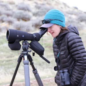
Equipment: Must have your own binoculars and/or spotting scope.
-
Field conditions: Surveys are done from a stationary location and do not require hiking or extensive physical exertion
-
Transportation to and from the site is your responsibility
Contact
For questions contact Teresa Wicks at twicks@birdallianceoregon.org or Joe Liebezeit at jliebezeit@birdallianceoregon.org.
To sign up for Community Count Days, click here.